OpalAi - Transforming Data Into Stunning 3D Models
OpalAi leverages state-of-the-art technology to redefine how data is processed and visualized. Our unique capabilities include:
- 3D Mapping: Utilizing LiDAR and advanced algorithms to create highly detailed spatial representations.
- LLaVa (Language and Visual Automation): Merging language understanding with visual data for comprehensive analyses.
- 3D Deep Learning: Implementing machine learning techniques that enhance model accuracy and efficiency.
- 3D Scene Understanding: Analyzing 3D environments to extract valuable insights and facilitate decision-making.
- 3D Reconstruction: Converting 2D and 3D data into coherent models for practical applications.
- 3D Information Modeling: Integrating complex data into meaningful and actionable information for various industries.
Using OpalAi is simple and effective. Follow these straightforward steps:
- Download the Scanto3D app: Available on iOS, install it on your mobile device.
- Capture your environment: Utilize your LiDAR or 360 camera to scan your area of interest.
- Upload your data: Send your scan or video recordings to our platform through the app.
- Generate models: Automatically create detailed 2D and 3D models within minutes.
- Analyze and assess: Utilize our powerful tools for insights into your scanned data, whether for building assessments, insurance claims, or urban planning.
- Save and share your models: Download or share the generated models directly for your project needs.
OpalAi is dedicated to revolutionizing the way industries utilize scan data. With our advanced technology, we not only streamline the modeling process but also enhance accuracy and efficiency. Whether in real estate, insurance, or transport management, OpalAi is your partner in creating detailed, actionable models from complex data. Join us in transforming the future of data analysis and modeling.
Features
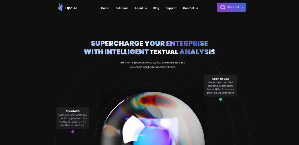
Scan to BIM
Generate a detailed Building Information Model (BIM) from your point cloud scan data effortlessly.
Scanto3D App
Create 2D and 3D CAD models in real-time using our Scanto3D mobile application.
Adjuster GPT
Utilize advanced Vision Language Models for rapid video analysis and insights.
Backed by Experts
Our technology is proven and supported by the National Science Foundation and top universities.
Industry Applications
Transform data for various sectors including PropTech, InsurTech, Retail, Space, and Transportation.
Technical Expertise
Leverage cutting-edge technology for accurate data processing and model creation.
Use Cases
Real Estate Development
Transform your real estate project with detailed 3D models derived from scanned data, allowing for efficient planning and visualization.
Insurance Claims Processing
Optimize insurance claim assessments by rapidly converting video footage into measurable data and actionable insights.
Retail Space Optimization
Improve warehouse efficiency by creating a digital twin of your retail space for enhanced navigation and planning.
Urban Infrastructure Management
Utilize advanced algorithms to monitor and assess city infrastructure, ensuring safe and efficient urban environments.
Satellite Imagery Analysis
Transform satellite data into actionable insights to aid in the detection of critical events like wildfires or vehicle movements.
Construction Project Management
Efficiently manage construction projects by monitoring progress and assessing project sights via detailed models and analyses.
FAQs
Traffic(2025-03)
Monthly Traffic
Traffic Source
Top Keywords
| Keyword | Traffic | Volume | CPC |
|---|---|---|---|
| astro adjuster | 116 | 100 | - |
| opalai | 77 | 920 | - |
| opalize ai | 40 | 140 | - |
Source Region
Whois
| Domain | www.opal-ai.com |
Featured Products
ExplodingTopics
Scribewave
EndorsedAi
LastMileAI
TubeBuddy
Glide
Supernormal
Roast Dating
Related Categories
Copy embed code
Alternative Products

Mailgo
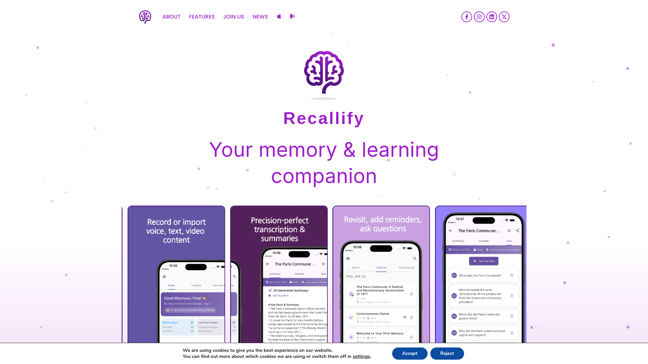

Recallify
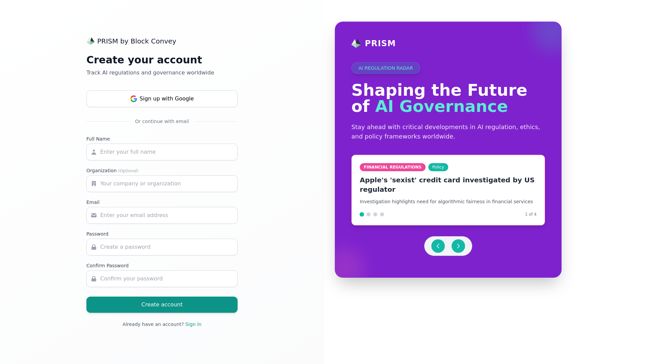

Prism
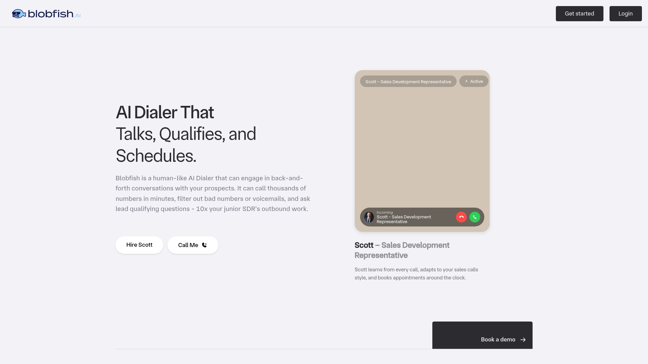

Blobfish AI
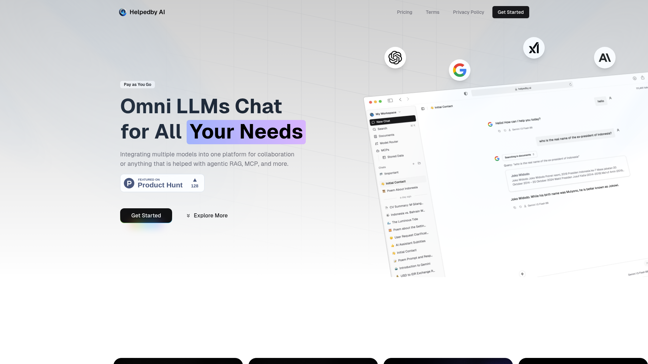

Helpedby AI

Outerspan


Play Ace